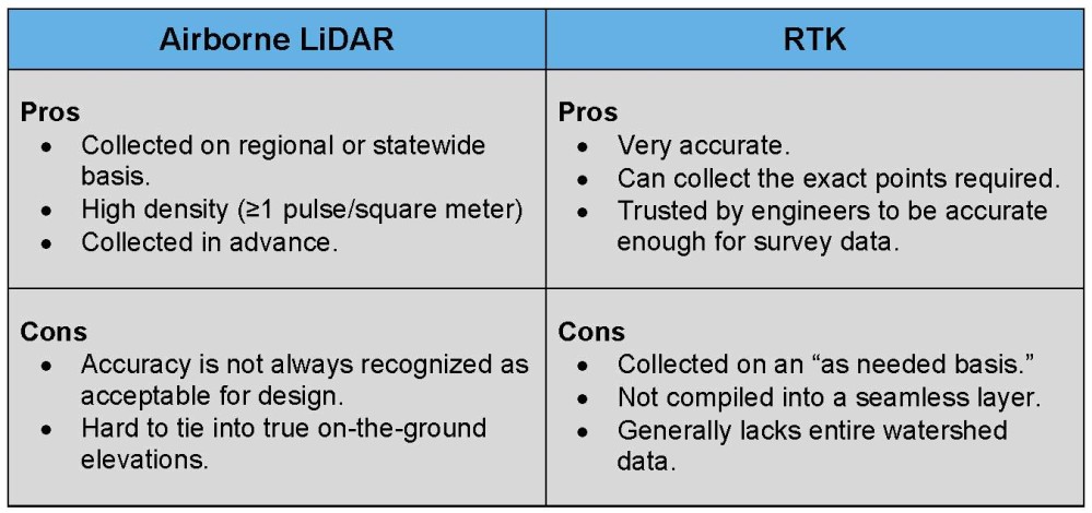
One of the most important data layers in Precision Conservation is the elevation layer, or topographic layer. But, there is one big question that needs to be answered. What is the best data source for Precision Conservation; LiDAR or RTK? The world of elevation data is changing so quickly it is hard to keep up. But even with all of the options the two most common types of elevation data, for conservation planning, are airborne LiDAR and RTK. Given that, which should we choose?
On one hand, we have airborne LiDAR data that is collected on a regional, if not a state-wide basis. LiDAR data is very dense, with at least one elevation reading every square meter, and is stitched together in one seamless layer. LiDAR data is easy-to-use with properly designed software once loaded on a hard drive. However, the downside of LiDAR is the accuracy, or at least the perceived accuracy. Initially, many engineers felt the airborne LiDAR data lacked the vertical accuracy needed to design soil and water conservation structures. Lastly, it can be difficult to tie LiDAR data to actual ground coordinates.
RTK data is definitely more accurate if collected properly. And, because the person is on the ground collecting the data, he can get the shots he desires. RTK data can be more accurate in heavy grass cover than LiDAR. However, RTK data is not normally collected with the same density as airborne LiDAR and it is only collected on a very local level. The engineer needs elevation data for the entire watershed when planning and designing most conservation practices. Sometimes, that means having access to the neighbor’s elevation data, which rarely happens.
When confronted with a decision of either LiDAR data or RTK, I think back to my studies in management. In the early 1900’s, Max Weber proposed a management style of bureaucracy. He and his supporters were absolutely convinced this was the most effective way to manage people in all situations. During the same time period, Frederick Taylor proposed Scientific Management as the best way to manage people. There were arguments between two theories as to the most effective management style for many years. These two styles were completely different and it was viewed as an “either/or” choice.
Thirty years later, the management theorist Joan Woodward formulated the Contingency Theory. The Contingency Theory claims that there is no best way to organize and lead a company. Instead, the optimal course of action is dependent upon the internal and external situation.
What is this grey area? Not an “either/or decision,” but instead an “it depends.” How can that be? After all of these years, it seems obvious that there is more than one management theory that is effective and of course it depends on circumstances as to how a manager should react.
What if we thought about the choice of airborne LiDAR and RTK in the same way? What if we had a system where LiDAR data could be augmented, or even replaced when necessary with RTK data? Imagine designing a pond. For the watershed analysis, we would access airborne LiDAR data. But when we designed the pond, we would use the RTK data for the actual design work.
Why not have access to two different elevation layers and use the right one for the right purpose? I have talked to several earthmoving contractors that like the idea of using LiDAR data to plan a structure. If the structure seems feasible, then collect the necessary RTK data to design the structure. Why would you invest the time to gather the RTK data before you do the feasibility study with the available LiDAR data? Think about it. Many contractors are strapped for time and don’t want to go through the effort of collecting RTK data if the site has no chance of working. These contractors like the option of using LiDAR data to see if the practice is feasible. Imagine how many practices could be planned in the off-season when it is difficult to get into the field. After the feasibility step …RTK data.
Hopefully, it will not take 30 years to learn that “it depends.” Hopefully, we can learn the lesson from management theory and just default to the contingency theory without years of fighting over LiDAR vs. RTK.
