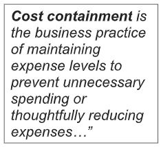
 As a conservation community, we spend very little effort on controlling the cost of soil and water conservation. Let’s face it, most of our efforts are spent on marketing conservation, working to increase funding, or fighting for or against regulations. When was the last time you heard anyone discuss effective ways to reduce the cost of conservation?
Any company knows that reducing cost, while maintaining the same quality, leads to more sales. Conservation is no different. If we expect farmers to install more conservation practices, we should focus on reducing the costs. These are my top 5 strategies to reduce the cost of conservation…
#5: Eliminate unnecessary requirements for engineering
States should eliminate engineering requirement for most soil and water conservation practices. Let’s face it. In many cases, a professional engineering is completely unnecessary. It simply increases the cost of doing business. Conservation practices, like grassed waterways, saturated buffers, terraces, or water & sediment control structures pose little to no liability, if they fail. The engineering costs often exceeds the cost of the practice itself. Nebraska got it right when they enacted the following exemption.
The provisions of the Engineers and Architects Regulation Act regulating the practice of architecture do not apply to the following activities:
#4: Machine control files should be provided for every project:
According to MachineGuidance.com.au, machine automation “not only displays the machine’s position, but it also directly controls the machine’s ground engaging tools. By controlling the machine hydraulics, the system is able to automatically move the blade/bucket towards the correct grade allowing the operator to concentrate on driving the machine. Construction accuracies can be greatly improved by using automated machine control systems.”
I realize this technology is nothing new in road construction. It seems like every dozer or grader on a road construction site has a GPS unit on each side of its blade. Yet, even though machine control files can be created for practices like ponds, wetlands, water & sediment basins, and terraces, machine control dozers for construction are not the norm. One contractor, who is currently using machine control, said that after completing a project, he can create a file of the final shape, which he then can develop into a “contractor check-out” file.
#3: Reduce surveying costs:
Staffing is a major cost in implementing soil and water conservation. Far too much time is spent on survey crews acquiring elevation data. However, the world of elevation data is changing so quickly that it is hard to keep up. In my July 9, 2014 post I wrote, “And let’s not forget, the drones are coming.” Since writing that, the possibilities for gathering survey data with drones has mushroomed. Not only can drones gather better survey data, they can also do it much cheaper. Just this week, I talked to Jeff Fagerman, CEO of LiDARUSA. Jeff told me they are selling drone systems that can collect LiDAR data accurate to 5 centimeters; and in an 8-hour day can collect topographic data on 6 to 8 projects, depending on travel time. With that degree of accuracy and economy, why are we staffing survey crews?
#2: Better software
While software design principles used today are sound, the applications have quickly become already sluggish, cumbersome and out of date. To get conservation on the ground, we need to work faster and smarter. But we need more than a few tweaks to the old stuff, because continuing to use the same basic methods while making small changes to the process, is a losing proposition. We need a paradigm shift, not a tweak, in the software development process. We should be creating software that easily integrates high resolution topographic data and saves time by automating many of the steps necessary to design ordinary conservation practices.
#1: Precision Conservation is a must
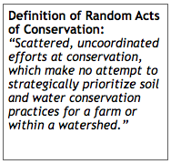
Farmers will continue to fall short of achieving water quality targets unless we, as conservationists, get serious about precision conservation. We simply cannot expect random acts of conservation to carry the day.
As an example, if a farmer signs up for a cover crop incentive payment, no attempt is made to identify those acres that lose the most nitrogen to surface water or ground water. Yet, scientists have long recognized that not every acre is created equal; that some acres within a field or some fields within a farm operation leach nitrogen at 2 to 3 times the rate. That makes no sense if we have limited resources, which we all do.
Conclusion:
The obstacles of achieving our soil and water conservation goals are enormous. We lack the financial and technical resources. We need to do more with less. I am not giving a pass to farmers, they need to do more. But if we expect farmers and landowners to do their part, we need help them prioritize their efforts and we must all work to reduce the cost of conservation.

 Is There A Flu Shot for Partially Drained Depressional Areas?
Thank you Tom for sharing. Your suggestions are practical and realistic, and as you mentioned, there is a need for teamwork between conservationists and farmers.
Thanks Joel for your comment. There are so many technological ways we can reduce the cost of conservation. We simply cannot hire enough staff people to implement the required conservation practices. We must figure out how to do more with less. And as you said that will take teamwork between conservationists, farmers, and technical service providers.
The IaRTN (real time network) is designed for machine control (i.e., land grading) and available to all. The IaRTN typically achieves an RTK accuracy of 1-2 cm horizontally and 2-3 cm vertically. A number of states have similar systems. Indeed, the Iowa DOT uses the system every day in every county across the state. Using a common system solves the problem of site specific accuracy associated with proprietary systems.
And then there is the Iowa DNR high resolution LIDAR system which covers the entire state and is available to all. I believe that it has a guaranteed accuracy of 8” statewide and is commonly much better than that.
What is sorely missing is people who know how to use the data. The software needed actually exists.
Lon, thanks for your comments. I think RTK could be useful, but I think collection elevation data with drones is probably a better solution. I definitely agree LiDAR is a completely under-utilized product. Depending on the practice it is probably not always good enough for a design but it certainly is good enough for planning. If we miss the design of a terrace by 6 to 8 inches that would not be good. New software technology will reduce the entry barriers for those using LiDAR. If technology is developed correctly, the LiDAR should be available for use with no extra effort or training. There is some talk about Iowa updating their LiDAR to a Level 2. This would be a huge asset to Iowa. However I really believe that Iowa should consider upgrading to a Level 1. Again, thanks for your comments.
I’m not familiar with the technology, but speaking just as a landowner, these ideas seem very reasonable. And I once heard someone within the NRCS say, privately, that some projects, because of the requirements, are over-engineered.
I also think that in the absence of regulations, we should ask whether we are investing enough in people who have the best professional current knowledge of what really motivates farmers to do good conservation, and who also have the skills and experience to apply that knowledge. I just read a blog post indicating that when a poll was taken at the recent Integrated Crop Management Conference, the biggest barrier to the adoption of edge-of-field practices was voted to be “Farmers and landowners are not feeling a sense of urgency to install these practices.” “Costs are too high” came in second. I don’t think “not feeling a sense of urgency” would go over well with many Iowa voters who are concerned about water quality.
Cindy, I fully support your comments. Although I don’t believe in regulation I do feel that if farmers get regulated they can largely blame themselves for not “feeling the sense of urgency”. I don’t know how to make that happen.
Hi Tom,
Lidar is available now in many areas for doing some initial planning. Trimble Ag software (disclaimer-I sell it) tends to prefer RTK survey, which has a higher degree of accuracy. It also allows intensive data gathering in problematic areas. The software can also be used for design and implementation. Many farmers and contractors in our area use it.
Regarding cover crops — I couldn’t agree more! I’m not sure how to move NRCS from its current mode into one that recognizes and pays for site-specific conservation. Not only should the payments be restricted for those areas, but there should also be a way of adding differential payments for higher priorities. This is true in all the practices. One way to achieve this is to reduce the cost share overall. Producers will then prioritize their money, helping NRCS to prioritize theirs by default!
Paul, thank you for your comment. I agree that RTK is a good tool, a really good tool. The reason I like LiDAR is that it is collected across the entire state. Therefore if a conservationists needs to plan a project with a farmer they can use LiDAR without expending any energy to collect topographic data. Also, on the positive side, the LiDAR continues to get better. There are some states that are starting to upgrade the quality of their LiDAR. For the benefits of RTK vs. LiDAR check out: https://precisionconservation.com/rtk-vs-lidar-or-rtk-lidar/. It was one of my very first blogs. An oldie but goody.
As for using our financial resource better, we should use a pay-for-performance system as I outlined in https://precisionconservation.com/pay-for-performance/
With Pay-for-performance a farmer gets paid for how many tons of topsoil they save or how many pounds of nitrogen they keep out of water; regardless of the practice they choose or their location. It assures us that we get the biggest bang for our buck.