
Follow along with this narrative: Installing conservation practices reduces in-field erosion. Reduced in-field erosion decreases the amount of sediment carried in a stream. Streams carrying less sediment have more energy. Streams with more energy result in additional streambank erosion. Added streambank erosion increases the sediment load in the stream. Ultimately the sediment load carried in the stream remains unchanged. In the end, applying upland conservation only shifts the source of the sediment load from upland erosion to …
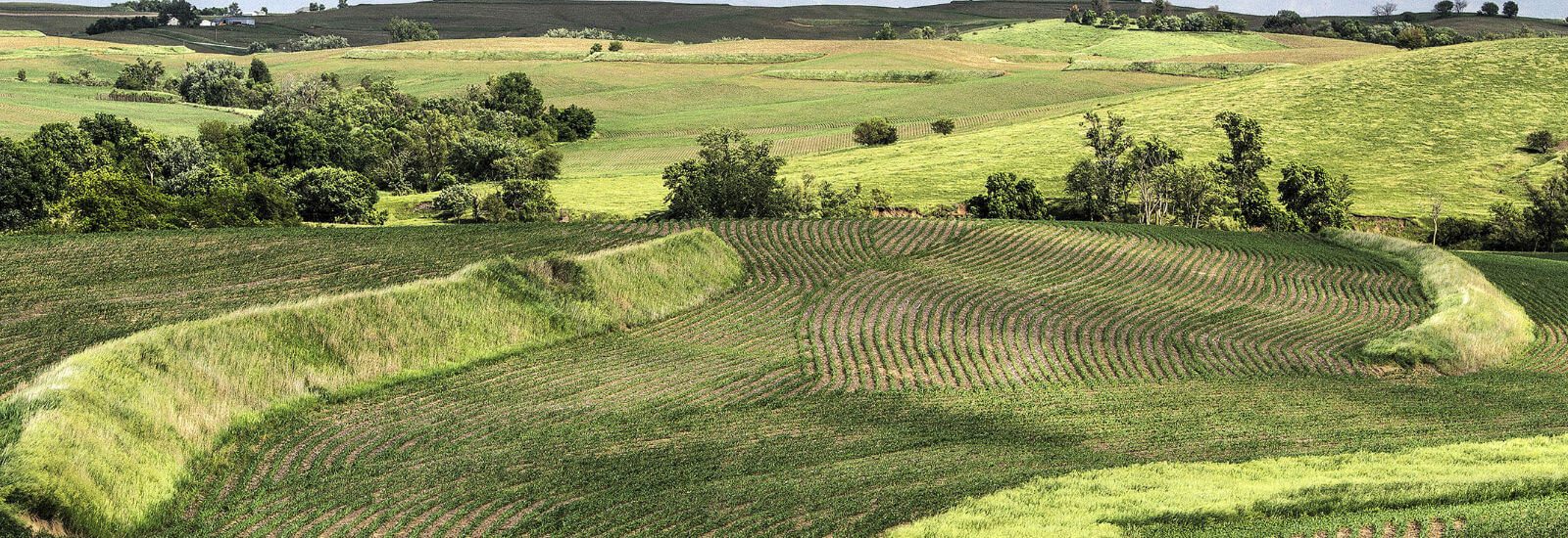
Grassed Waterways – The Ugly Duckling of BMPs
Last week I was in a discussion with Dr. Mark Tomer, ARS National Laboratory of Agriculture and Environment, about the amount of research that exists, or more importantly the amount of research that does NOT exist, on the efficacy of grassed waterways. Dr. Tomer agreed there was very little research done on grassed waterways, but quickly added he could not imagine submitting a project proposal for grassed waterways because it is assumed, by most funding institutions, that grassed waterways are completely researched and …
Unintended Consequences
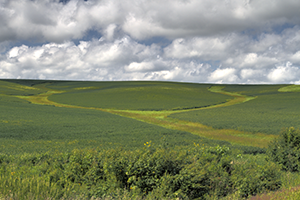
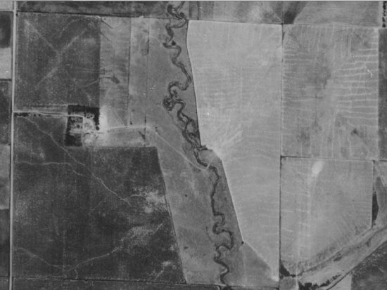
I never knew my Grandpa Buman. He died before I was born. My dad describes Grandpa as “progressive.” In the 1940’s Grandpa decided it was too laborious to farm the curvy creek and so he straightened his ½ mile of Silver Creek in Shelby County, Iowa.Back then, straightening creeks was a common practice. I am sure, given Grandpa’s progressive nature, he was one of the first to straighten his section of the creek. Figure 1 is a photo taken in the 1930’s of Grandpa’s section of creek. Figure 2 shows the same segment in 2011, now owned by my …
RTK vs. LiDAR – or – RTK & LiDAR
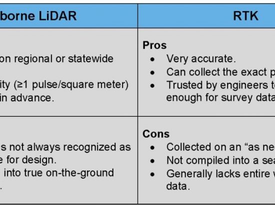
One of the most important data layers in Precision Conservation is the elevation layer, or topographic layer. But, there is one big question that needs to be answered. What is the best data source for Precision Conservation; LiDAR or RTK? The world of elevation data is changing so quickly it is hard to keep up. But even with all of the options the two most common types of elevation data, for conservation planning, are airborne LiDAR and RTK. Given that, which should we choose?On one hand, we have airborne LiDAR data that is collected on a …

Why Not Precision Conservation?
This week I am pleased to have as my guest writer, Jim Gulliford, Executive Director of the Soil and Water Conservation Society (SWCS). SWCS is a professional society dedicated to promoting the science and art of natural resource conservation and has been a leader in encouraging the adoption of precision conservation. Jim has more than 30 years professional experience administering natural resource protection programs in agriculture and for the Environmental Protection Agency. I first met Jim back in the early 1980’s when I was a young NRCS …
Professional Publications
Opportunity now: Integrate conservation with precision agriculture Jul/Aug 2013 Journal of Soil and Water Conservation Technologies For Efficient Manure Utilization and Nutrient Management Nov 19, 2003 3rd International Methane & Nitrous Oxide Mitigation Conference, Beijing, China Engaging absentee landowners in conservation practice decisions: A descriptive study of an understudied group May/June 2009 Journal of Soil and Water Conservation Reaching out to absentee landowners Mar 2007 Journal of Soil and Water …